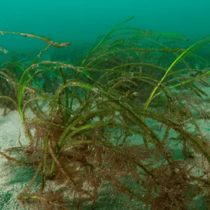
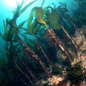
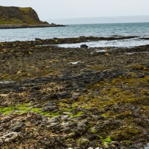
Kelp forest beauty of Anacapa Island, Channel Islands National Park.

The link between Marine Protected Areas and Blue Carbon

What is blue carbon and why is it so important?

The ocean plays a crucial role in absorbing carbon dioxide (CO2) emissions generated by human activity every year, helping to mitigate the effects of global climate change.

Blue carbon habitats are areas of coastal and marine systems that capture and store carbon! Blue carbon habitats in Northern Ireland such as seagrass meadows, kelp forests, saltmarsh, maerl and shellfish beds are considered to be as important as peatlands in sequestering and storing carbon.

What happens if blue carbon habitats are damaged?

If blue carbon habitats are lost or damaged, the CO2 will be released back into the atmosphere, so it is important that we protect and restore these natural carbon stores in Northern Ireland as a Nature-Based Solution to climate change.

The protection of the carbon in coastal ecosystems, not only provides essential benefits for climate change adaptation, including coastal flood and erosion protection, but also many other benefits to people, such as recreational opportunities, storm protection, and nursery habitat for commercial and recreational fisheries.

Marine Protected Areas and conservation work in Northern Ireland

We have 48 Marine Protected Areas (MPAs) in Northern Ireland covering a total of 38% of the inshore area.  Active management of these sites includes assessments for every application received (planning, marine licencing, consent and assent) near or in the coastal or marine area to determine if these are likely to have any adverse impacts on marine protected features. Where activities can be carried out sustainably these may proceed with or without conditions.

DAERA undertakes site integrity monitoring on our MPAs either by land or by sea and records activities that may be causing damage or disturbance.  In addition, management groups have been established for some of our MPAs and these involve stakeholders with a range of interests in the marine area. Projects such as MarPAMM (Marine Protected Areas Management and Monitoring) in collaboration with stakeholders and partner projects COMPASS and SeaMonitor aims to develop 6 comprehensive MPA management plans, for Ireland, Northern Ireland and Western Scotland.

A DAERA diver monitoring the condition of a seagrass meadow in rathlin SAC

Future Blue Carbon habitat restoration and creation

DAERA recently provided funding support to Ulster Wildlife to undertake a Blue Carbon Habitat Restoration Feasibility Study to determine the current extent of coastal blue carbon habitats and identify areas suitable for restoration or habitat creation work.

This study was delivered in partnership with the National Oceanography Centre and the University of Hull. The final report can be viewed on the Ulster Wildlife website: https://www.ulsterwildlife.org/

Blue Carbon post 2020

DAERA’s post 2020 biodiversity, green growth and environmental policy frameworks, currently under development, will include ecosystem management and dedicated conservation efforts to ensure that coastal ecosystems and blue carbon habitats continue to play their role as long-term carbon sinks.

A number of restoration projects are already underway across the UK and Ireland, for example Project Seagrass:

Blue Carbon habitats in Northern Ireland

Skerries and Causeway SAC

Skerries and Causeway SAC is a 30km wide embayment on the North Coast of Northern Ireland. It was designated a Special Area of Conservation (SAC) for reef, sandbanks slightly covered by seawater at all times, submerged or partially submerged sea caves and harbour porpoise. The marine habitats here are influenced by the warm Gulf Stream and strong currents which run through the North Channel, to which the SAC is exposed.

The Maidens SAC

The Maidens SAC is formed by a group of small rocky reefs off north east Larne. Just two of these are large enough to be considered islands, known as West Maiden with an abandoned lighthouse and East Maiden with a functioning lighthouse. The Maidens SAC was designated for the following features: reef, sandbanks which are slightly covered by seawater, grey seal (Halichoerus grypus). 

Rathlin Island SAC

Rathlin Island is a large inhabited marine island situated some 4km from the north Antrim coast of Northern Ireland. There are basalt and chalk cliffs, some as high as 100 metres, as well as several sea stacks on the north and west shores of the island. The south and east shores are more gently sloping with areas of maritime grassland and rocky shore. The length of the coastline is approximately 30 km.

Rathlin Island SAC was designated for the following marine features: submerged or partially submerged sea caves, reefs and sandbanks which are slightly covered by seawater all of the time,

Blue carbon habitats are also present within other Marine Protected Areas in Northern Ireland.

A Marine Conservation Zone (MCZ) at Waterfoot, Co. Antrim, is designated specifically to protect subtidal seagrass meadows in the bay (Zostera marina), and seagrass is also found in Strangford Lough.

Related articles

Marine Conservation and Disturbance

Marine Conservation and Disturbance

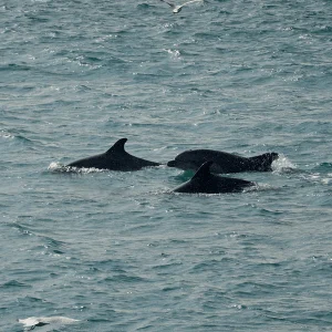
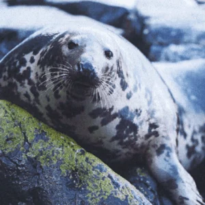
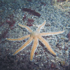
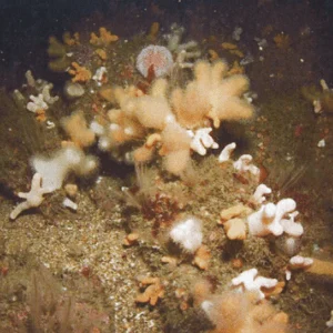
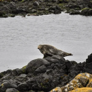
The waters around NI are full of a rich array of marine wildlife including dolphins, sharks, seals, jellyfish and much more. We have eleven species