The Origins of the Coastal Path
Prior to 1970, it was not possible to walk along the shoreline from Holywood to Bangor, although there had been suggestions for a Coastal Path. A good deal of the land was in private ownership, some of it held by the Big Houses as part of their estates, for example Clandeboye or Crawfordsburn House.
In September 1966, an initial meeting was held to examine the proposal in the Plan for the Greater Belfast Area produced by Sir Robert Matthew for a coastal path. Professor Arthur Muskett, chairman of the Ulster Countryside Committee, was to chair the Committee.
Then, the County Down Spectator announced on 24 March 1967 that the Ministry of Development had finalised the scheme for the creation of a continuous path from Holywood to Groomsport which would require the acquisition of some 45 acres of land, nearly half at Grey Point and Crawfordsburn. The Minister, WK Fitzsimons, emphasised that there was no intention to create an esplanade, but toilet facilities, litter bins and benches would be provided at appropriate points. A coordinating committee, with representatives of the local authorities (including Bangor, Holywood and Castlereagh District Councils), Down County Council, the Ministry and the National Trust was set up to ensure that the path was established. That summer, Bangor Borough Council instructed its surveyor to prepare a scheme for the construction of a walk between Carnalea and Swineley Bay, with an access path from the railway station at Carnalea to the shore.
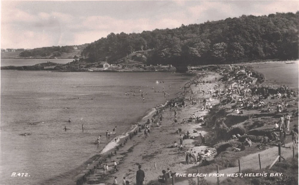
In the 1950s, the Clandeboye Estate tried for some years to implement a scheme for charging the public for access to Helen’s Bay beach. There was then no formal path between the beach and the golf course, just historic sand dunes. Access to Crawfordsburn beach had been private up to this point, as the land was then owned by the Northern Ireland Hospitals Authority.
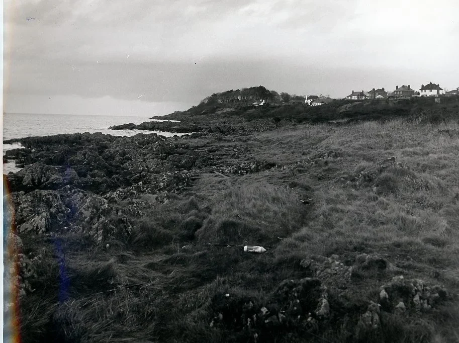
Officials in the Ministry tried to acquire the house at the western end of Helen’s Bay beach to create a continuous path from the beach round Grey Point, but the cost was too great, and walkers are obliged to make a short detour along the road pavement.
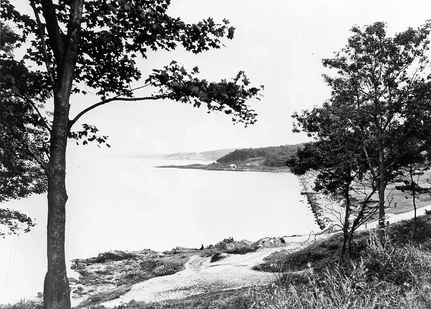
In 1970, the Spectator reported that the official opening of North Down Coastal Path, from Holywood to Groomsport, had been postponed until the following year. It noted that part of the path was already in existence by then, and it was possible to complete the walk, though not when the tide was high.
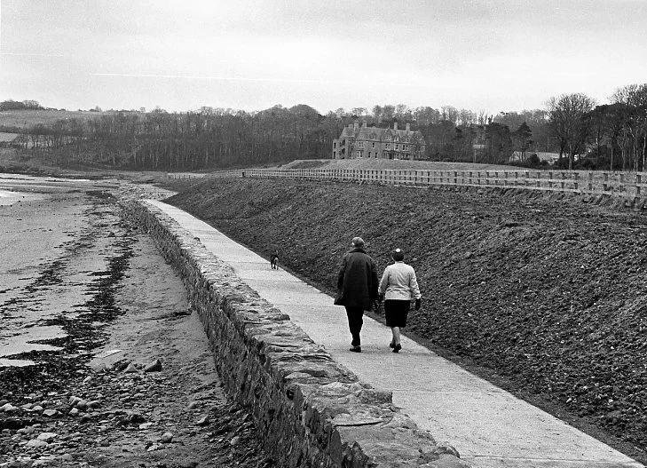
Prior to the opening of Crawfordsburn Country Park in 1971, work to create the path between Seapark below the Coastguard Cottages at Helen’s Bay and Swineley Bay was undertaken. This involved a novel construction of a sloping seawall at the rear of the Helen’s Bay and Crawfordsburn beaches, with large boulders placed with gaps so that the seawater could pass between them. This work was undertaken by the Royal Engineers as part of the military aid to the civil community; it has stood the test of time very well. (Prior to that, there had been a vertical solid wall, with, in some areas, wooden groynes in the beach, which can still be seen on occasions when the sand is reduced.)
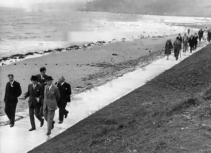
At the opening of the Country Park that year, the VIPs walked along the section of the newly-opened Coastal Path behind Crawfordsburn beach.
The section of the Coastal Path from Helen’s Bay to Holywood forms part of the Ulster Way.